| 
|

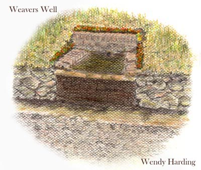
Weaver's Well
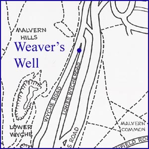
NGR 77399 44848
Site Number: C88
By Bruce Osborne and Cora Weaver (C) 2012
Area 4. West Malvern Springs and Wells
Malvern Hills, England
In 1897 an application was made to the Council committee for a drinking trough at the Wyche. The committee was reminded that previous drinking water facilities had been wantonly destroyed so the members were pleased to hear from Dr Charles Grindrod 'that the dwellers at The Wyche have improved, therefore may be trusted with a trough. It would be exceedingly serviceable for man and beast'.[1] Despite this the committee could not recommend that the Council should provide one. They did agree, however, that if a trough appeared through private enterprise - perhaps via the Society of Prevention of Cruelty to Animals - the water could be supplied free of charge. Dr Grindrod noted two areas where troughs might be useful. One was on the east side of the Wyche Cutting, the other to the north east of the Cutting, though here a small removal of rocks would be required.
The following year the Council surveyor was instructed to prepare the ground for a new drinking fountain and trough at the Wyche.[2] The concomitant installation was Weavers Well, which was built at the top end of Lower Wyche Road for cattle, donkeys and horses. It also served as a source of water for the steam-driven quarrying machinery operating in the area in the 1920s and 30s. This water feature was rediscovered by Cora Weaver and Bruce Osborne in the 1990s and named after her in the absence of any previous name. Suitably modified it could perhaps accommodate the general public's wish for a collection point for hill water.
Weavers Well was renovated in the early 21st century as a result of the Heritage Lottery Fund/matched funding scheme.
Further information:
Nearby, at the top of the Wyche Road is the reservoir from which Evendine, Colwall and Hayslad reservoirs are linked. Being the highest reservoir in the public supply collector main system it relies on gravity to keep the supply system full.
Footnotes:
[1] Malvern Advertiser, 11 Sept 1897.
[2] Malvern Advertiser, 9 Apr 1898.
Website: Click Here
SUPPLEMENTARY INFORMATION

Celebrated Springs of
THE MALVERN HILLS
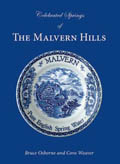 A definitive work that is the culmination of 20 years researching the springs and wells of the Malvern Hills, published by Phillimore. This is the ideal explorers guide enabling the reader to discover the location and often the astounding and long forgotten history of over 130 celebrated springs and wells sites around the Malvern Hills. The book is hard back with dust cover, large quarto size with lavish illustrations and extended text. Celebrated Springs contains about 200 illustrations and well researched text over a similar number of pages, together with seven area maps to guide the explorer to the locations around the Malvern Hills. It also includes details on the long history of bottling water in the Malvern Hills.
Written by Bruce Osborne and Cora Weaver, this book is available on-line for £15.00 (delivered UK) - click Malvern Bookshop on the green panel top left. Alternatively send a cheque payable to Cora Weaver with your name and address to 4 Hall Green, Malvern, Worcs. WR14 3QX.
1) TOPOGRAPHICAL LOCATION:
Malvern Hills - arguably Britain's original National Park
2) LANDSCAPE:
Uplands3) INFORMATION CATEGORY:
A Spring, Spout, Fountain or Holy Well Site4) MALVERN SPRING OR WELL SITE DETAILS:
Site with Malvern Water4 SPLASHES - Well Worth Finding

5) GENERAL VISITOR INFORMATION:
Access By RoadAccess On Foot
Free Public Access
Free Parking Nearby
Disabled access
Accessible All Year


