| 
|

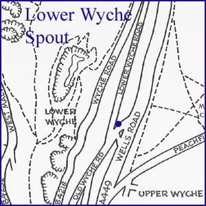
Lower Wyche Spout
NGR 77264 44239
Site Number: C84
By Bruce Osborne and Cora Weaver (C) 2012
Area 4. West Malvern Springs and Wells
Malvern Hills, England
This spout is one of Charles Morris's three undertakings and dates from 1840. The barely legible plaque reads: 'Erected for the inhabitants of the neighbourhood by Charles Morris Jn Esq 1840'.
The tank held approximately ten thousand gallons of spring water and provided a useful and easily accessible domestic water supply for local people in the years before there was a mains water supply. The spout is low down to prevent people filling large barrels in the summer, when water was scarce, and leaving little water for others. The watering of animals in the vicinity of the ancient and dangerously steep Old Wyche Road was of some concern to the Victorians. The spout and its adjacent horse trough were used for watering the teams of eight horses which at one time were used by wagons to assist climbing the steep Old Wyche Road.
The tank is behind the spout and access is through a manhole on the top which is covered by soil and grass. When the authors gained access to the tank in the 1990s they found an old metal water filter and a lady's shoe, probably made of silk and dated c.1850s. When the shoe was retrieved it quickly disintegrated, but not before being photographed. It also resulted in a visit by the police who were bemused at the sight of various adults disappearing below ground on a Sunday afternoon.
With the assistance of Heritage Lottery/matched funding in the early twenty-first century, major conservation work was carried out at this site as a tribute and memorial to Charles Morris' benefaction.
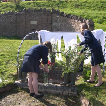
1. Dressing for the annual celebrations.
Website: Click Here
SUPPLEMENTARY INFORMATION

Celebrated Springs of
THE MALVERN HILLS
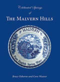 A definitive work that is the culmination of 20 years researching the springs and wells of the Malvern Hills, published by Phillimore. This is the ideal explorers guide enabling the reader to discover the location and often the astounding and long forgotten history of over 130 celebrated springs and wells sites around the Malvern Hills. The book is hard back with dust cover, large quarto size with lavish illustrations and extended text. Celebrated Springs contains about 200 illustrations and well researched text over a similar number of pages, together with seven area maps to guide the explorer to the locations around the Malvern Hills. It also includes details on the long history of bottling water in the Malvern Hills.
Written by Bruce Osborne and Cora Weaver, this book is available on-line for £15.00 (delivered UK) - click Malvern Bookshop on the green panel top left. Alternatively send a cheque payable to Cora Weaver with your name and address to 4 Hall Green, Malvern, Worcs. WR14 3QX.
1) TOPOGRAPHICAL LOCATION:
Malvern Hills - arguably Britain's original National Park
2) LANDSCAPE:
Rolling Countryside3) INFORMATION CATEGORY:
Springs and Wells General Interest4) MALVERN SPRING OR WELL SITE DETAILS:
Site with Malvern Water5 SPLASHES - Prime 'Must See' Site

5) GENERAL VISITOR INFORMATION:
Access By RoadAccess On Foot
Free Parking Nearby
Disabled access
Accessible All Year


